


Last July I had attempted to go to Lake Ingalls with my daughter but had to cut it short. So I decided to go again and complete it. To get to the trailhead, you have to drive over a potholed unpaved forest road for eight miles. In July it took us over two and half hours to get to the trailhead from my home in Sammamish, as we got a little confused by the markers on the unpaved road that did not mention the Lake Ingalls trail. So we back tracked a bit to confirm the direction but then figured out we were on the right track.
The parking lot can hold about 25-30 cars. But is usually packed and cars line along the road to the parking lot, if you come late. However if you reach there even later in the afternoon, like us, you can get lucky and find some spots left open by early birds who finish the hike by afternoon.
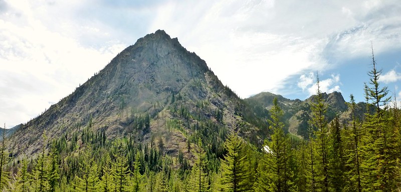
Esmeralda peak looms large at the trailhead which is the starting point for the trail to Esmeralda basin as well as to Lake Ingalls. The trail continues upriver and stays close to a creek that merges with the Teanaway creek further down. Less than a quarter mile uphill the trail forks right towards Lake Ingalls and the Esmeralda basin trail continues on.
 The switchbacks start from here and climb steadily up through some tree cover and then open up to meadows. You can see wide open vistas with Esmeralda peak standing prominently to the south.
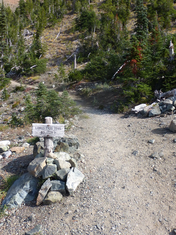 Shortly afterwards the trail comes to the junction of Long’s pass trail. The trail to Long’s pass splits here and goes steeply above and provides a great view of Mt Stewart at its end. We continued towards Lake Ingalls. The narrow trail from here gently moves north across steep mountain side for over a mile steadily climbing up.
 When I went in July the meadows were covered in dwarf lupines and green grasses. I could also see some snow cover on the northern slopes and shaded areas of the mountains.
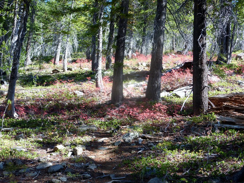 However this time there was no snow as expected this late in the season, but fall colors were visible with bushes turning burning read, yellow and brown in many patches along the trail.
 After gently ambling for about a mile the switchbacks start again. All this while the scenery keeps getting better as you climb higher and higher and then crosses into the Alpine lake wilderness region.
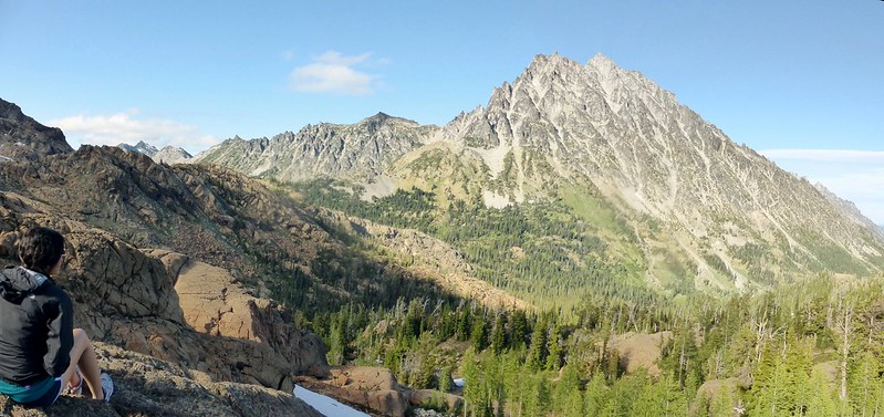
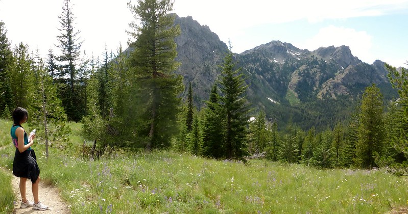
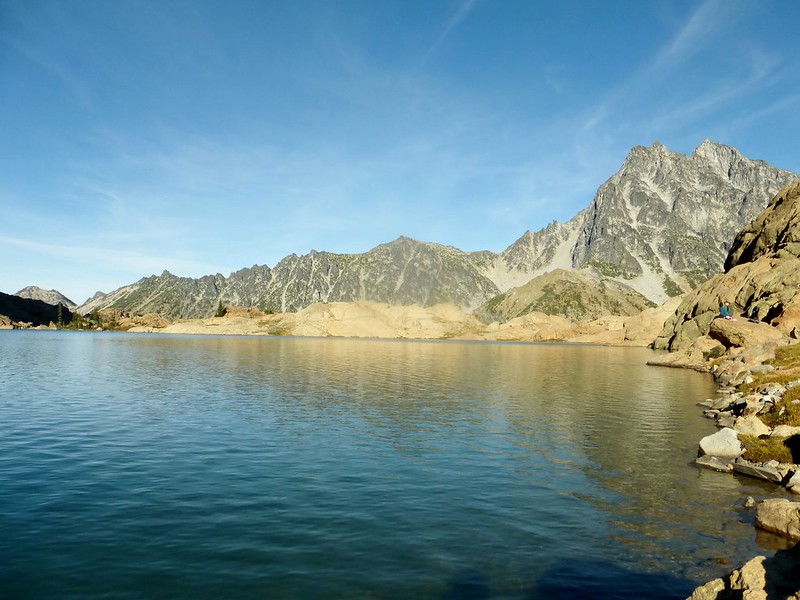
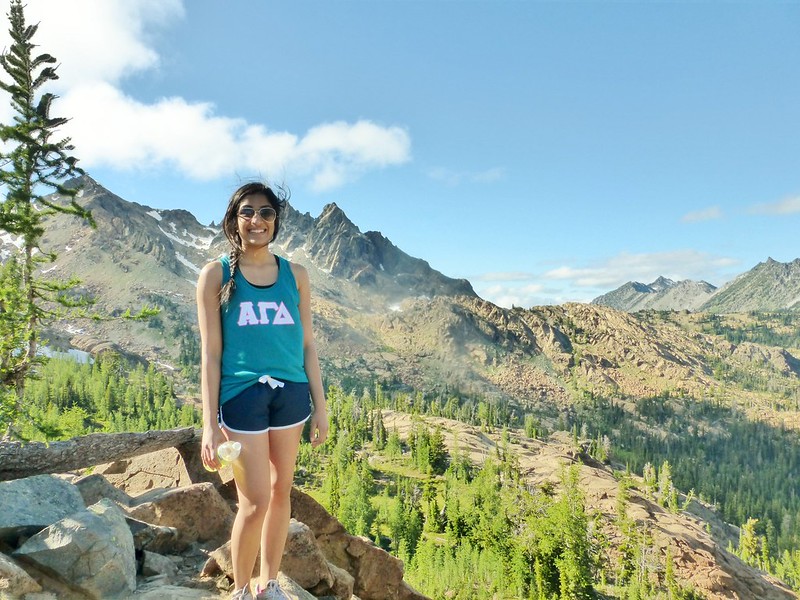 Just a little bit across the alpine lake boundary you reach a ridge that provides a fantastic view of Mt Stewart and Ingalls peak and the valley in between. It is a good place to take a break and enjoy the scenery.
When I came here in July, the weather was warm and sunny when we started at the trailhead however as we crossed into the alpine wilderness area the weather started changing and soon became very windy and cloudy. We still had about a mile over boulders and rough trail left to reach the lake. Even though I had extra warm layers, but given that the light was also quickly fading and it was getting cold, we decided to call it a day and return.
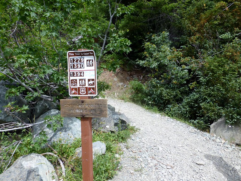
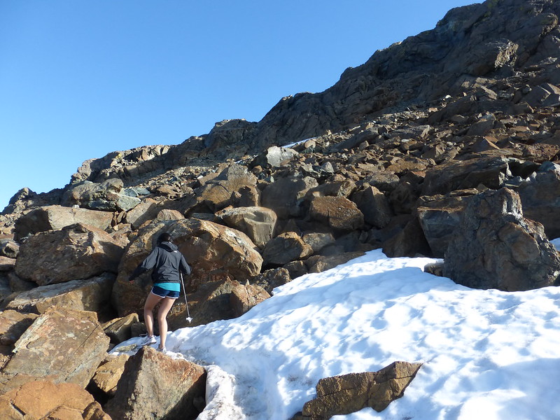
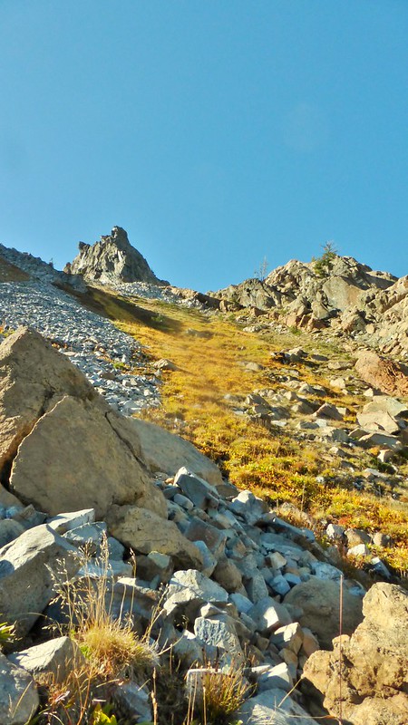
The trail is very rocky from here on except for a brief respite as it crosses a large shaded meadow with streams running through it from snow melt. There are some campsites here too. Camping at the lake is not allowed. The trail stays close to the Ingalls Peak range. It is easy to lose the trail in the rocky terrain so it’s important to keep a watch out for cairns.
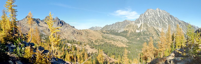

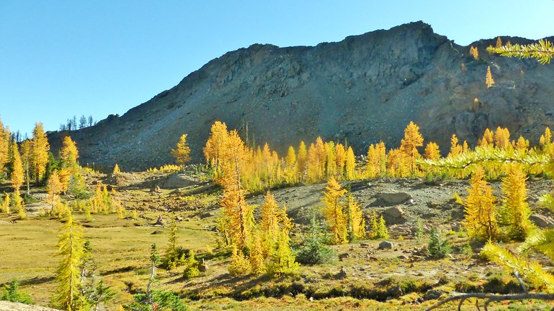
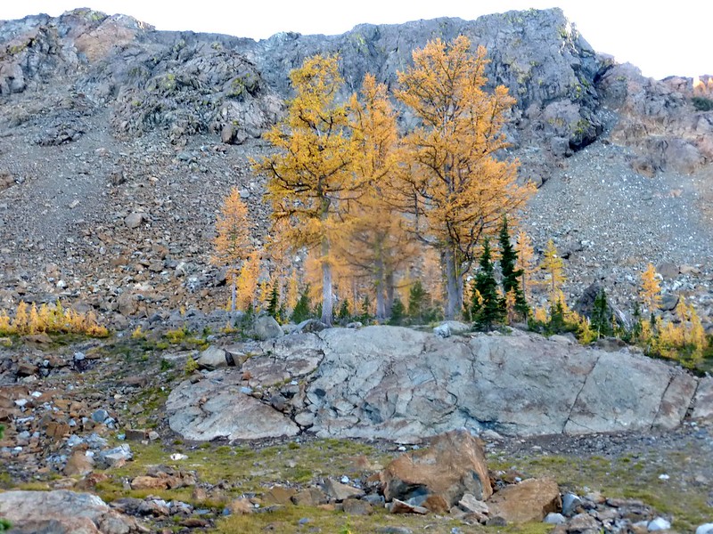
 The larches had almost peaked in the valley and the meadow this time I went. It was wonderful to see the blast of golden trees all around the valley and the meadows. It more than compensated the snow that makes this place so wonderful in spring/early summer.
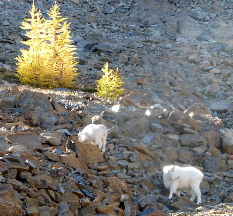
 To add to all this beauty I lucked out and saw a family of mountain goats, a mommy with her yearling, grazing just off of the meadows.
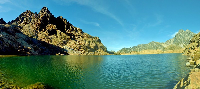 After about a mile or so and across numerous boulders, the trail reaches the lake, approaching from the south. The lake sits just behind a ridge below the Ingalls peak. There did not seem to be a way to go around the lake to the northern end of the lake which is where it empties its waters into Ingalls creek. The color of the water, just like other alpine lakes, is blue aquamarine to green depending on where light falls on it or the direction you look at. It is a beautiful lake engulfed by the Ingalls peak on the west and Mt Stewart to the east. There is not much tree cover here. It would have been out of the world if larches were here too.
 I spent a long time here refueling and enjoying the view. I had started late so most of the people had left and were already on the way down. I shared the lake with just another couple. The trail is so popular that I felt lucky I could find myself without any crowd here. It was very serene.
 As the sun started setting I wrapped up and started my trek back. I took many pictures of the larches in the valley and meadow on the way back trying to capture the beauty and retain the memories. Coming down as usual was much quicker that climbing up. But as I was late to start by the time I reached the parking lot darkness had already set in and there were only a few cars left in the parking lot. I took a break while changing my shoes and after a quick snack started back home. It was a long hard day but worth it. It always feels great to complete a hike, it makes my day.
To get a detailed trip description see the WTA guide. Check the full album of the hike on my Flickr site.
